A Topographical Map of Hart-fordshire
By Andrew Dury and John Andrews, 1766
Hertfordshire has always been one of England’s best mapped counties but the map that appeared in 1766 set a completely new standard in its cartography. At the scale of 1.95 inches to the mile it showed in far greater detail a county that, while still essentially rural in character, was increasingly dominated by its proximity to London. The county, particularly on its southern fringes, became the natural choice for the capital’s elite to display their wealth and success in the form of grand houses and parks. Initially it attracted royal courtiers and politicians but increasingly it was lawyers, bankers, city merchants, brewers and retired military officers who chose to make their home in the county.
The map shows the major roads reaching north out of London - Watling Street, the Great North Road and Ermine Street (the Old North Road). With the capital being so close the towns within the county never grew to a great size and compared to other counties there are comparatively few heaths and commons. The map preceded the first Ordnance Survey by forty years and the inhabitants of 18th century Hertfordshire could not have foreseen the industrialisation of the Lea Valley, the coming of the canals and railways, the spread of suburbia and the creation of Garden Cities.
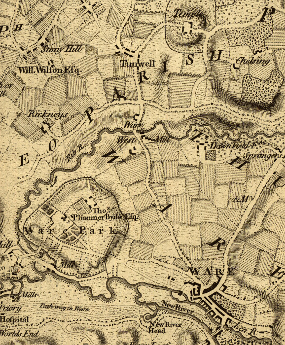
Extract from the original map including the town of Ware